MapPlanner
10.643mi
Distance
1h43m
Duration
9:41/mi
Pace
Hard
Level

Défi 1

Route details

6.2mph
Speed
1178 kcal
Calories burned
Loop trail
Route type
574ft
Min altitude
968ft
Max altitude

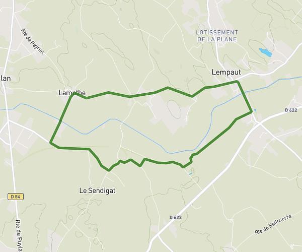
This running route covers 10.643mi starting from Lautrec, Tarn. The run is a loop trail and returns to the trailhead. This run is rated as hard, expect about 1h43m to complete it. The route has an elevation gain of 689ft and an elevation loss of 682ft.

Route profile

689ft
Elevation gain
682ft
Elevation loss
574ft
Min altitude
968ft
Max altitude

How to get there

Trailhead: Chemin Des Caparouniès, 81440 Lautrec

GPS coordinates of the trailhead: 43.69055, 2.13785 / 43°41'25'' N, 2°8'16'' E

Caution: May Cross Private Property

This route may pass through or near private property. Always respect posted signs, obtain permission where required, and follow local trespassing laws. MapPlanner does not guarantee public access along any route.

Safety Notice

Trail and road conditions may change without notice due to weather, construction, or other factors. Always verify current conditions before heading out. You are responsible for your own safety — follow local signage, obey traffic laws, and use your best judgment on the trail.