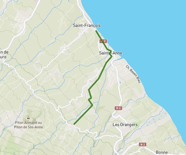
This running route covers 3.804mi starting from Saint-Benoît, Reunion. The run does not return to the trailhead and ends near 9 Chemin Carreau Sirop, 97437, Saint-Benoît, Reunion. This run is rated as easy, expect about 40m48s to complete it. The route has an elevation gain of 827ft and an elevation loss of 59ft.
Sainte anne
Route details
5.59mph
Speed
466 kcal
Calories burned
Point to point
Route type
23ft
Min altitude
804ft
Max altitude
Route profile
827ft
Elevation gain
59ft
Elevation loss
23ft
Min altitude
804ft
Max altitude
How to get there
Trailhead: N 2, 97437, Saint-François, Saint-Benoît, Reunion
GPS coordinates of the trailhead: -21.071409, 55.737913 / 21°4'17'' S, 55°44'16'' E