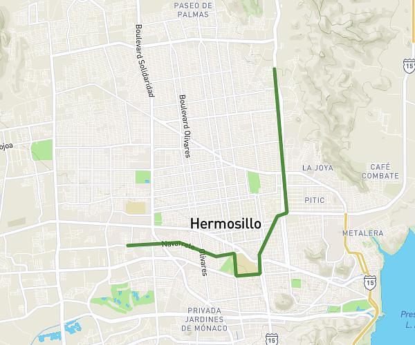
This running route covers 7.397mi starting from Hermosillo, Sonora. The run does not return to the trailhead and ends near Calle Vía Palermo, 83104 Hermosillo, Sonora, Mexico. This run is rated as moderate, expect about 1h19m to complete it. The route has an elevation gain of 528ft and an elevation loss of 180ft.
tamman x tamman
Route details
5.59mph
Speed
907 kcal
Calories burned
Point to point
Route type
627ft
Min altitude
988ft
Max altitude
Route profile
528ft
Elevation gain
180ft
Elevation loss
627ft
Min altitude
988ft
Max altitude
How to get there
Trailhead: San Agustín 25, 83249 Hermosillo, Sonora, Mexico
GPS coordinates of the trailhead: 29.0887, -111.000102 / 29°5'19'' N, 111°0'0'' W