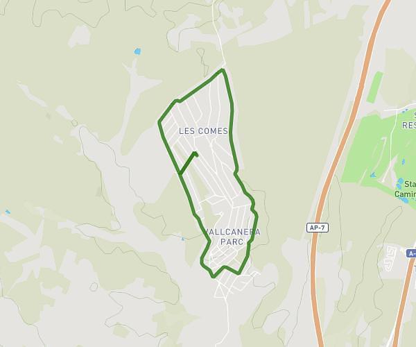
This running route covers 3.868mi starting from Sils, Girona. The run is a loop trail and returns to the trailhead. This run is rated as easy, expect about 42m to complete it. The route has an elevation gain of 328ft and an elevation loss of 325ft.
Ruta perifèria Vallcanera
Route details
5.52mph
Speed
480 kcal
Calories burned
Loop trail
Route type
282ft
Min altitude
476ft
Max altitude
Route profile
328ft
Elevation gain
325ft
Elevation loss
282ft
Min altitude
476ft
Max altitude
How to get there
Trailhead: Carrer De Pau Casals 54, 17410 Sils, Girona, Spain
GPS coordinates of the trailhead: 41.854459, 2.732925 / 41°51'16'' N, 2°43'58'' E