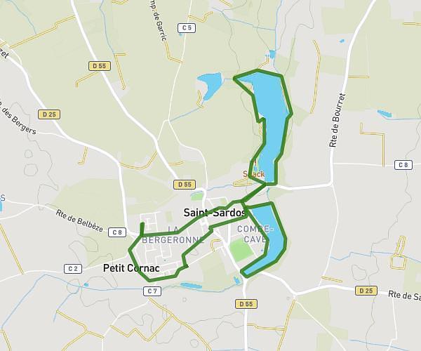
This running route covers 6.734mi starting from Montauban, Tarn-et-Garonne. The run is a loop trail and returns to the trailhead. This run is rated as moderate, expect about 58m to complete it. The route has an elevation gain of 13ft and an elevation loss of 13ft.
fioting
Route details
6.97mph
Speed
663 kcal
Calories burned
Loop trail
Route type
344ft
Min altitude
358ft
Max altitude
Route profile
13ft
Elevation gain
13ft
Elevation loss
344ft
Min altitude
358ft
Max altitude
How to get there
Trailhead: 259 Avenue De Léojac, 82000 Montauban, France
GPS coordinates of the trailhead: 44.021456, 1.380473 / 44°1'17'' N, 1°22'49'' E