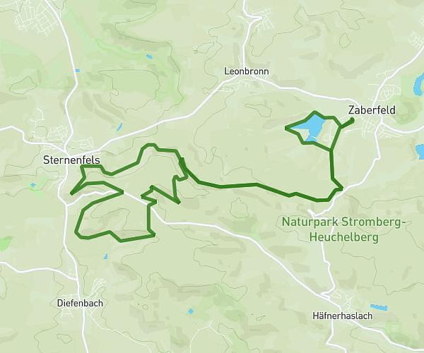
This running route covers 4.417mi starting from Mühlhausen, Baden-Württemberg. The run does not return to the trailhead and ends near Am Röhrigwald 24, 74918 Angelbachtal, Germany. This run is rated as easy, expect about 47m23s to complete it. The route has an elevation gain of 328ft and an elevation loss of 253ft.
14 km
Route details
5.59mph
Speed
542 kcal
Calories burned
Point to point
Route type
463ft
Min altitude
587ft
Max altitude
Route profile
328ft
Elevation gain
253ft
Elevation loss
463ft
Min altitude
587ft
Max altitude
How to get there
Trailhead: Dielheimer Straße 10, 69242 Mühlhausen, Germany
GPS coordinates of the trailhead: 49.248819, 8.727486 / 49°14'55'' N, 8°43'38'' E