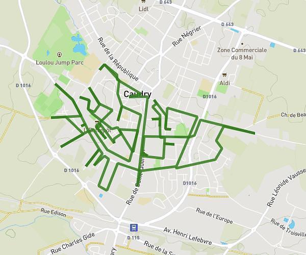
This running route covers 13.14mi starting from Aulnoy-lez-Valenciennes, Nord. The run is a loop trail and returns to the trailhead. This run is rated as strenuous, expect about 2h6m to complete it. The route has an elevation gain of 95ft and an elevation loss of 108ft.
Semi marathon
Route details
6.26mph
Speed
1441 kcal
Calories burned
Loop trail
Route type
75ft
Min altitude
184ft
Max altitude
Route profile
95ft
Elevation gain
108ft
Elevation loss
75ft
Min altitude
184ft
Max altitude
How to get there
Trailhead: 50 Avenue De La Libération Du 2 Septembre 1944, 59300 Aulnoy-lez-Valenciennes, France
GPS coordinates of the trailhead: 50.327829, 3.52232 / 50°19'40'' N, 3°31'20'' E