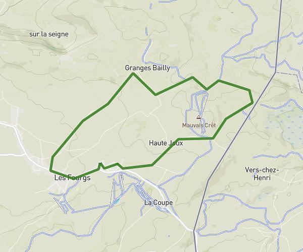
This running route covers 6.249mi starting from Orbe, Vaud. The run does not return to the trailhead and ends near Route D'orbe 4, 1321 Arnex-sur-Orbe, Switzerland. This run is rated as moderate, expect about 54m to complete it. The route has an elevation gain of 371ft and an elevation loss of 112ft.
Entrainement semi marathon
Route details
6.94mph
Speed
617 kcal
Calories burned
Point to point
Route type
1519ft
Min altitude
1785ft
Max altitude
Route profile
371ft
Elevation gain
112ft
Elevation loss
1519ft
Min altitude
1785ft
Max altitude
How to get there
Trailhead: Rue De La Tournelle 8, 1350 Orbe, Switzerland
GPS coordinates of the trailhead: 46.72252, 6.53334 / 46°43'21'' N, 6°32'0'' E