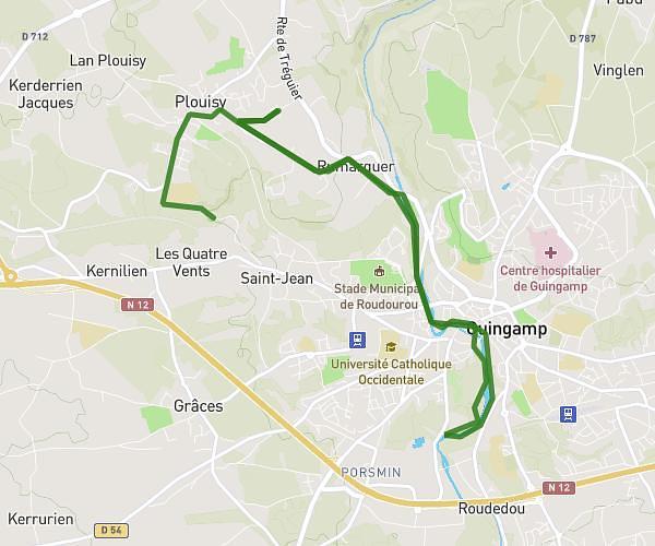
This running route covers 3.742mi starting from Guingamp, Côtes-d'Armor. The run is a loop trail and returns to the trailhead. This run is rated as easy, expect about 40m to complete it. The route has an elevation gain of 10ft and an elevation loss of 26ft.
Guingamp1
Route details
5.61mph
Speed
457 kcal
Calories burned
Loop trail
Route type
223ft
Min altitude
240ft
Max altitude
Route profile
10ft
Elevation gain
26ft
Elevation loss
223ft
Min altitude
240ft
Max altitude
How to get there
Trailhead: 13 Route De Corlay, 22200 Guingamp, France
GPS coordinates of the trailhead: 48.556877, -3.150364 / 48°33'24'' N, 3°9'1'' W