MapPlanner
11.07mi
Distance
4h
Duration
+2201ft
Elevation gain
-2178ft
Elevation loss
Strenuous
Level

firsti elbi

Route details

2.77mph
Speed
1785 kcal
Calories burned
7.5%
Avg grade
Loop trail
Route type
397ft
Min altitude
1171ft
Max altitude

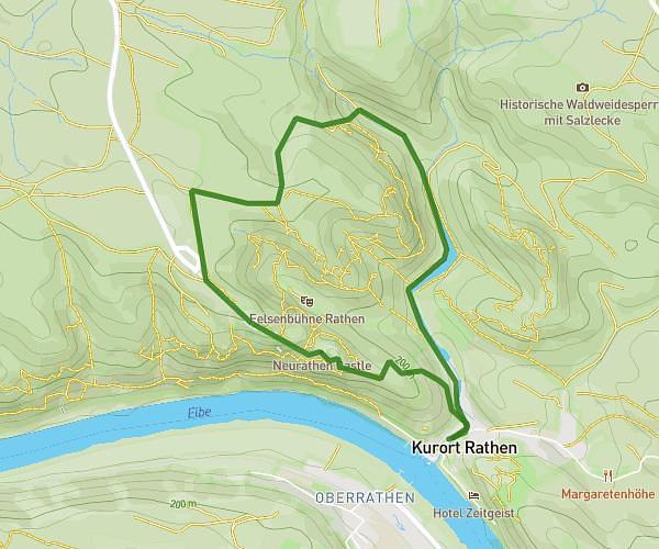
This hiking trail covers 11.07mi starting from Rathen, Saxony. The hike is a loop trail and returns to the trailhead. This hike is rated as strenuous, plan for about 4h to complete it. The route has an elevation gain of 2201ft and an elevation loss of 2178ft.

Route profile

2201ft
Elevation gain
2178ft
Elevation loss
397ft
Min altitude
1171ft
Max altitude

How to get there

Trailhead: Wehlener Weg 1, 01824 Rathen, Germany

GPS coordinates of the trailhead: 50.958149, 14.081003 / 50°57'29'' N, 14°4'51'' E

Caution: May Cross Private Property

This route may pass through or near private property. Always respect posted signs, obtain permission where required, and follow local trespassing laws. MapPlanner does not guarantee public access along any route.

Safety Notice

Trail and road conditions may change without notice due to weather, construction, or other factors. Always verify current conditions before heading out. You are responsible for your own safety — follow local signage, obey traffic laws, and use your best judgment on the trail.