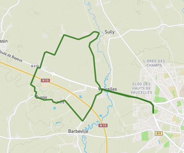
This running route covers 6.414mi starting from Banneville-la-Campagne, Calvados. The run is a loop trail and returns to the trailhead. This run is rated as moderate, expect about 1h20m to complete it. The route has an elevation gain of 266ft and an elevation loss of 262ft.
10kms banneville
Route details
4.81mph
Speed
915 kcal
Calories burned
Loop trail
Route type
20ft
Min altitude
75ft
Max altitude
Route profile
266ft
Elevation gain
262ft
Elevation loss
20ft
Min altitude
75ft
Max altitude
How to get there
Trailhead: 19 Le Ru De Banneville, 14940 Banneville-la-Campagne, France
GPS coordinates of the trailhead: 49.177716, -0.215619 / 49°10'39'' N, 0°12'56'' W