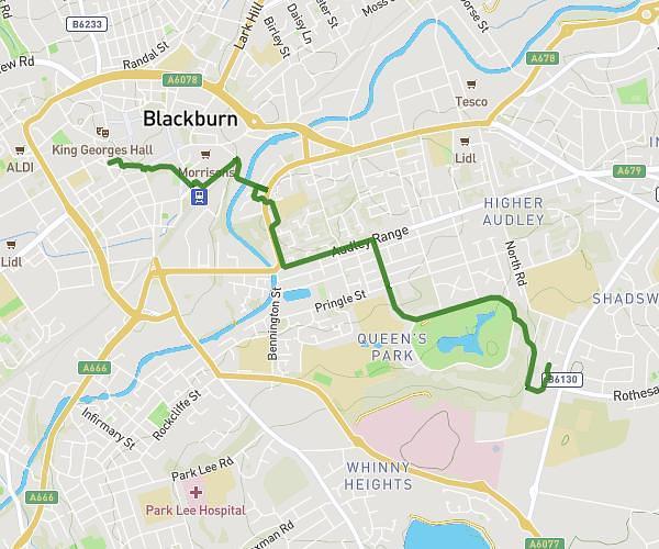
This cycling route covers 8.019mi starting from Preston, England. The ride does not return to the trailhead and ends near 12 Braintree Avenue, Penwortham, Preston, PR1 9UN, United Kingdom. This route is rated as easy, plan for about 48m to complete it. The route has an elevation gain of 262ft and an elevation loss of 259ft.
Docks 29 sep
Route details
423 kcal
Calories burned
1.2%
Avg grade
Point to point
Route type
13ft
Min altitude
115ft
Max altitude
Route profile
262ft
Elevation gain
259ft
Elevation loss
13ft
Min altitude
115ft
Max altitude
How to get there
Trailhead: 275 Leyland Road, Penwortham, Preston, PR1 9SY, United Kingdom
GPS coordinates of the trailhead: 53.73372, -2.70157 / 53°44'1'' N, 2°42'5'' W