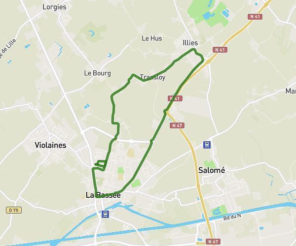
This running route covers 2.239mi starting from Lille, Nord. The run is a loop trail and returns to the trailhead. This run is rated as easy, expect about 27m1s to complete it. The route has an elevation gain of 49ft and an elevation loss of 49ft.
Running facile
Route details
4.97mph
Speed
309 kcal
Calories burned
Loop trail
Route type
82ft
Min altitude
98ft
Max altitude
Route profile
49ft
Elevation gain
49ft
Elevation loss
82ft
Min altitude
98ft
Max altitude
How to get there
Trailhead: 23 Place Gentil Muiron, 59800 Lille, France
GPS coordinates of the trailhead: 50.63168, 3.06676 / 50°37'54'' N, 3°4'0'' E