MapPlanner
16.281mi
Distance
1h15m
Duration
+371ft
Elevation gain
-371ft
Elevation loss
Moderate
Level

Great Neck - long ride

Route details

13.0mph
Speed
530 kcal
Calories burned
0.9%
Avg grade
Loop trail
Route type
10ft
Min altitude
95ft
Max altitude

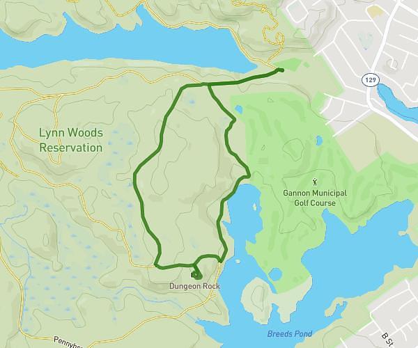
This hiking trail covers 16.281mi starting from Ipswich, Massachusetts. The hike is a loop trail and returns to the trailhead. This hike is rated as moderate, plan for about 1h15m to complete it. The route has an elevation gain of 371ft and an elevation loss of 371ft.

Route profile

371ft
Elevation gain
371ft
Elevation loss
10ft
Min altitude
95ft
Max altitude

How to get there

Trailhead: North Ridge Road, 01938 Ipswich

GPS coordinates of the trailhead: 42.70665, -70.81248 / 42°42'23'' N, 70°48'44'' W

Caution: May Cross Private Property

This route may pass through or near private property. Always respect posted signs, obtain permission where required, and follow local trespassing laws. MapPlanner does not guarantee public access along any route.

Safety Notice

Trail and road conditions may change without notice due to weather, construction, or other factors. Always verify current conditions before heading out. You are responsible for your own safety — follow local signage, obey traffic laws, and use your best judgment on the trail.