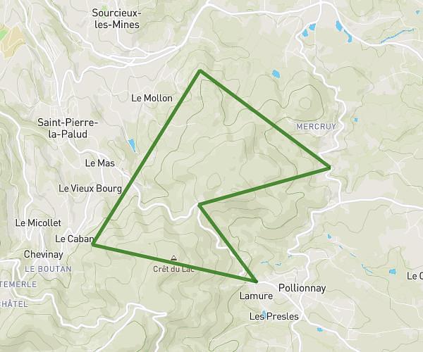
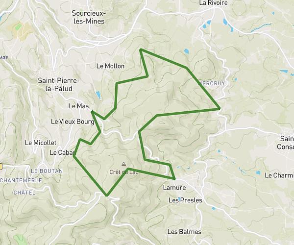
This running route covers 3.746mi starting from Marcilly-d'Azergues, Rhône. The run is a loop trail and returns to the trailhead. This run is rated as easy, expect about 40m to complete it. The route has an elevation gain of 272ft and an elevation loss of 262ft.
Reprise
Route details
5.62mph
Speed
457 kcal
Calories burned
Loop trail
Route type
591ft
Min altitude
728ft
Max altitude
Route profile
272ft
Elevation gain
262ft
Elevation loss
591ft
Min altitude
728ft
Max altitude
How to get there
Trailhead: 41 Chemin Des Grandes Terres, 69380 Marcilly-d'Azergues, France
GPS coordinates of the trailhead: 45.871308, 4.728056 / 45°52'16'' N, 4°43'41'' E