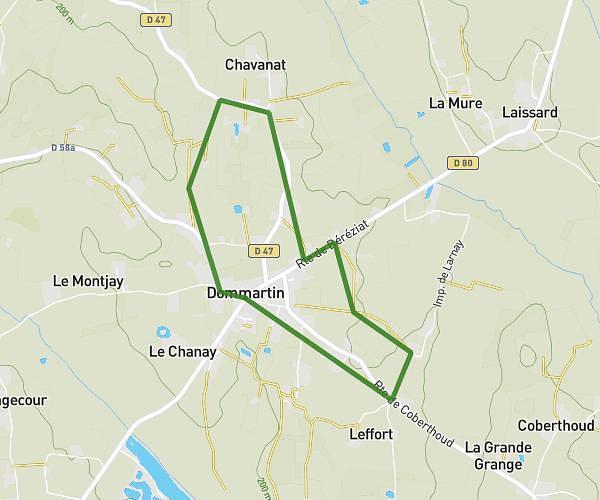
This running route covers 6.281mi starting from Bâgé-Dommartin, Ain. The run does not return to the trailhead and ends near Route Du Cimetière, 01380 Bâgé-Dommartin, France. This run is rated as moderate, expect about 1h19m to complete it. The route has an elevation gain of 335ft and an elevation loss of 335ft.
Niermont cour
Route details
4.77mph
Speed
903 kcal
Calories burned
Point to point
Route type
594ft
Min altitude
689ft
Max altitude
Route profile
335ft
Elevation gain
335ft
Elevation loss
594ft
Min altitude
689ft
Max altitude
How to get there
Trailhead: Route Du Cimetière, 01380 Bâgé-Dommartin, France
GPS coordinates of the trailhead: 46.315063, 4.94827 / 46°18'54'' N, 4°56'53'' E