MapPlanner
13.854mi
Distance
4h32m
Duration
+341ft
Elevation gain
-341ft
Elevation loss
Easy
Level

Auen Blick

Route details

3.06mph
Speed
1919 kcal
Calories burned
0.9%
Avg grade
Loop trail
Route type
-43ft
Min altitude
33ft
Max altitude

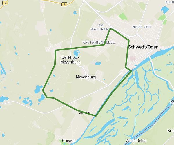
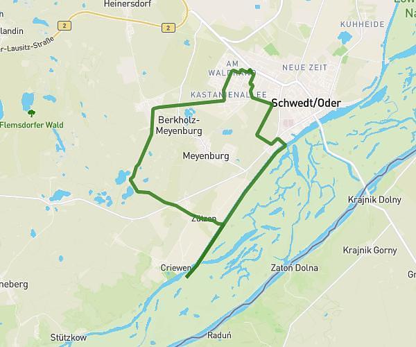
This hiking trail covers 13.854mi starting from Schwedt, Brandenburg. The hike is a loop trail and returns to the trailhead. This hike is rated as easy, plan for about 4h32m to complete it. The route has an elevation gain of 341ft and an elevation loss of 341ft.

Route profile

341ft
Elevation gain
341ft
Elevation loss
-43ft
Min altitude
33ft
Max altitude

How to get there

Trailhead: Am Schöpfwerk, 16303 Schwedt, Germany

GPS coordinates of the trailhead: 53.046688, 14.274547 / 53°2'48'' N, 14°16'28'' E

Caution: May Cross Private Property

This route may pass through or near private property. Always respect posted signs, obtain permission where required, and follow local trespassing laws. MapPlanner does not guarantee public access along any route.

Safety Notice

Trail and road conditions may change without notice due to weather, construction, or other factors. Always verify current conditions before heading out. You are responsible for your own safety — follow local signage, obey traffic laws, and use your best judgment on the trail.