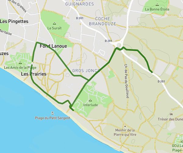
This running route covers 8.677mi starting from La Rochelle, Charente-Maritime. The run is a loop trail and returns to the trailhead. This run is rated as hard, expect about 1h27m to complete it. The route has an elevation gain of 13ft and an elevation loss of 20ft.
parcours 2 la rochelle
Route details
5.98mph
Speed
995 kcal
Calories burned
Loop trail
Route type
7ft
Min altitude
20ft
Max altitude
Route profile
13ft
Elevation gain
20ft
Elevation loss
7ft
Min altitude
20ft
Max altitude
How to get there
Trailhead: Rue De La Croisette, 17000 La Rochelle
GPS coordinates of the trailhead: 46.15836, -1.12825 / 46°9'30'' N, 1°7'41'' W