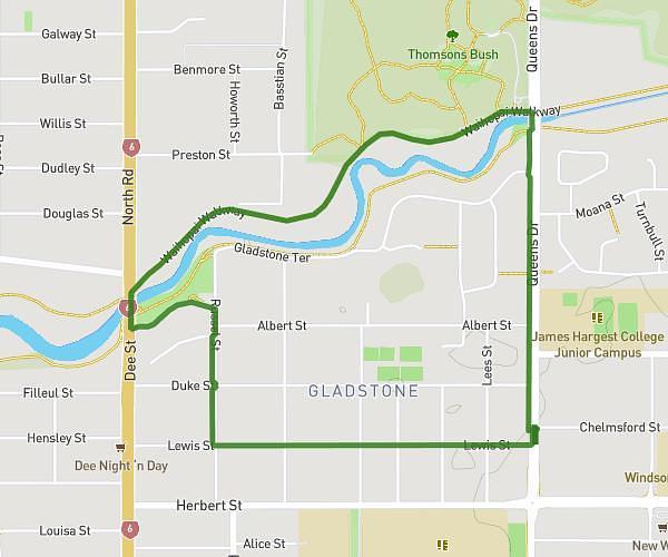
This walking route covers 3.269mi starting from Invercargill, Southland. The walk is a loop trail and returns to the trailhead. This walk is rated as moderate, plan for about 1h2m to complete it. The route has an elevation gain of 180ft and an elevation loss of 177ft.
Park
Route details
18:58/mi
Pace
253 kcal
Calories burned
Loop trail
Route type
16ft
Min altitude
72ft
Max altitude
Route profile
180ft
Elevation gain
177ft
Elevation loss
16ft
Min altitude
72ft
Max altitude
How to get there
Trailhead: 412 Queens Drive, Windsor, Invercargill 9810, New Zealand
GPS coordinates of the trailhead: -46.392861, 168.361042 / 46°23'34'' S, 168°21'39'' E