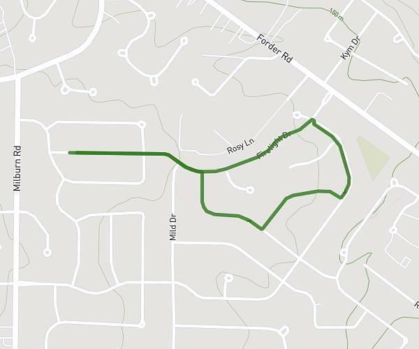
This walking route covers 1.441mi starting from Ferguson, Missouri. The walk is a loop trail and returns to the trailhead. This walk is rated as easy, plan for about 31m to complete it. The route has an elevation gain of 190ft and an elevation loss of 190ft.
Route 2 - Prayer Walk Connecting Churches (Ferguson)
Route details
21:30/mi
Pace
127 kcal
Calories burned
Loop trail
Route type
535ft
Min altitude
604ft
Max altitude
Route profile
190ft
Elevation gain
190ft
Elevation loss
535ft
Min altitude
604ft
Max altitude
How to get there
Trailhead: 330 North Florissant Road, Ferguson, Missouri 63135, United States
GPS coordinates of the trailhead: 38.75017, -90.30818 / 38°45'0'' N, 90°18'29'' W