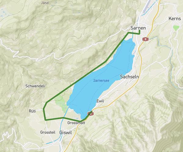
This running route covers 8.078mi starting from Sarnen, Obwalden. The run does not return to the trailhead and ends near Schwerzbachstrasse 2, 6074 Giswil, Switzerland. This run is rated as hard, expect about 1h17m to complete it. The route has an elevation gain of 627ft and an elevation loss of 617ft.
Training Sarnersee-Lauf 13km
Route details
6.29mph
Speed
880 kcal
Calories burned
Point to point
Route type
1542ft
Min altitude
1719ft
Max altitude
Route profile
627ft
Elevation gain
617ft
Elevation loss
1542ft
Min altitude
1719ft
Max altitude
How to get there
Trailhead: Brünigstrasse 158, 6060 Sarnen, Switzerland
GPS coordinates of the trailhead: 46.894608, 8.245209 / 46°53'40'' N, 8°14'42'' E