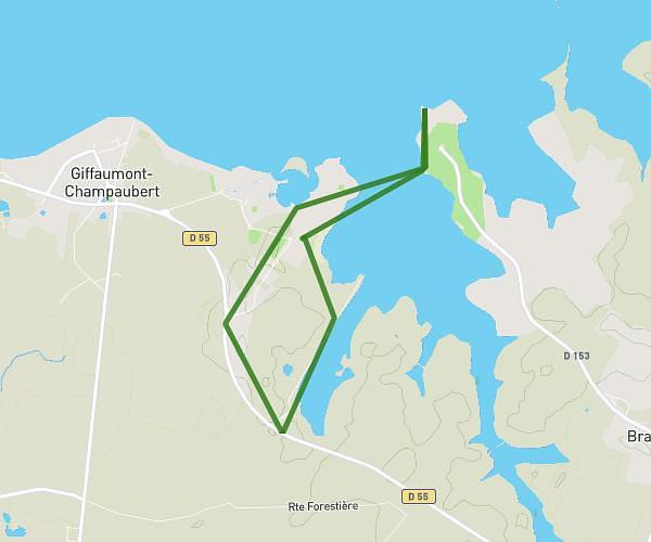
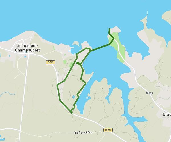
This running route covers 4.032mi starting from Giffaumont-Champaubert, Marne. The run is a loop trail and returns to the trailhead. This run is rated as easy, expect about 45m to complete it. The route has an elevation gain of 33ft and an elevation loss of 33ft.
Giffaumont 1
Route details
5.37mph
Speed
515 kcal
Calories burned
Loop trail
Route type
456ft
Min altitude
489ft
Max altitude
Route profile
33ft
Elevation gain
33ft
Elevation loss
456ft
Min altitude
489ft
Max altitude
How to get there
Trailhead: Résidence Marina Holyder, 51290 Giffaumont-Champaubert, France
GPS coordinates of the trailhead: 48.550704, 4.774682 / 48°33'2'' N, 4°46'28'' E