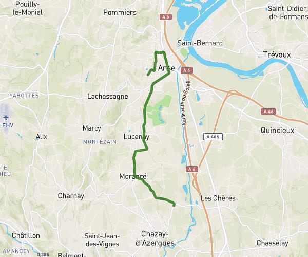
This running route covers 9.482mi starting from Lyon, Rhône. The run is a loop trail and returns to the trailhead. This run is rated as hard, expect about 1h32m to complete it. The route has an elevation gain of 505ft and an elevation loss of 512ft.
15k Lyon
Route details
6.18mph
Speed
1052 kcal
Calories burned
Loop trail
Route type
535ft
Min altitude
614ft
Max altitude
Route profile
505ft
Elevation gain
512ft
Elevation loss
535ft
Min altitude
614ft
Max altitude
How to get there
Trailhead: 85 Rue De La Part-Dieu, 69003 Lyon, France
GPS coordinates of the trailhead: 45.759666, 4.84869 / 45°45'34'' N, 4°50'55'' E