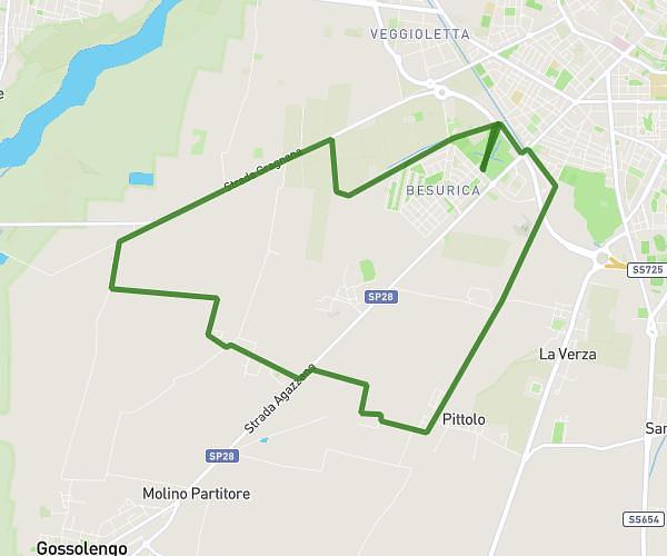
This running route covers 6.565mi starting from Gossolengo, Piacenza. The run is a loop trail and returns to the trailhead. This run is rated as moderate, expect about 2h16m to complete it. The route has an elevation gain of 39ft and an elevation loss of 36ft.
Quarto 2025 km 4
Route details
2.9mph
Speed
1555 kcal
Calories burned
Loop trail
Route type
276ft
Min altitude
315ft
Max altitude
Route profile
39ft
Elevation gain
36ft
Elevation loss
276ft
Min altitude
315ft
Max altitude
How to get there
Trailhead: Via Calciati 2, 29020 Gossolengo Piacenza, Italy
GPS coordinates of the trailhead: 44.99711, 9.66174 / 44°59'49'' N, 9°39'42'' E