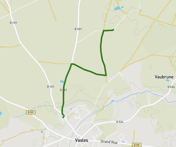
This walking route covers 3.26mi starting from Vasles, Deux-Sèvres. The walk is a loop trail and returns to the trailhead. This walk is rated as moderate, plan for about 1h10m to complete it. The route has an elevation gain of 115ft and an elevation loss of 112ft.
Chemin there & back
Route details
21:27/mi
Pace
286 kcal
Calories burned
Loop trail
Route type
518ft
Min altitude
548ft
Max altitude
Route profile
115ft
Elevation gain
112ft
Elevation loss
518ft
Min altitude
548ft
Max altitude
How to get there
Trailhead: 2 Impasse De La Périnche, 79340 Vasles, France
GPS coordinates of the trailhead: 46.57957, -0.02928 / 46°34'46'' N, 0°1'45'' W