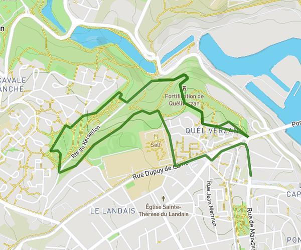
This running route covers 13.635mi starting from Brest, Finistère. The run is a loop trail and returns to the trailhead. This run is rated as strenuous, expect about 2h26m to complete it. The route has an elevation gain of 965ft and an elevation loss of 968ft.
Prépa 20km
Route details
5.59mph
Speed
1673 kcal
Calories burned
Loop trail
Route type
161ft
Min altitude
312ft
Max altitude
Route profile
965ft
Elevation gain
968ft
Elevation loss
161ft
Min altitude
312ft
Max altitude
How to get there
Trailhead: 52 Rue Yves Giloux, 29200 Brest, France
GPS coordinates of the trailhead: 48.415076, -4.486584 / 48°24'54'' N, 4°29'11'' W