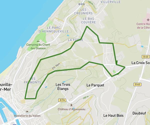
This running route covers 7.438mi starting from Cléville, Calvados. The run is a loop trail and returns to the trailhead. This run is rated as moderate, expect about 1h35m to complete it. The route has an elevation gain of 82ft and an elevation loss of 108ft.
Canteloup
Route details
4.7mph
Speed
1086 kcal
Calories burned
Loop trail
Route type
13ft
Min altitude
118ft
Max altitude
Route profile
82ft
Elevation gain
108ft
Elevation loss
13ft
Min altitude
118ft
Max altitude
How to get there
Trailhead: 40 Château Pigache, 14370 Cléville, France
GPS coordinates of the trailhead: 49.142364, -0.079674 / 49°8'32'' N, 0°4'46'' W