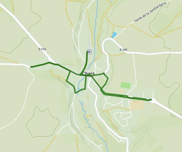
This walking route covers 3.086mi starting from Ermont, Val-d'Oise. The walk is a loop trail and returns to the trailhead. This walk is rated as easy, plan for about 49m to complete it. The route has an elevation gain of 128ft and an elevation loss of 128ft.
Essai
Route details
15:53/mi
Pace
200 kcal
Calories burned
Loop trail
Route type
148ft
Min altitude
200ft
Max altitude
Route profile
128ft
Elevation gain
128ft
Elevation loss
148ft
Min altitude
200ft
Max altitude
How to get there
Trailhead: Rue Du Docteur Rosenfeld, 95120 Ermont
GPS coordinates of the trailhead: 48.98537, 2.2495 / 48°59'7'' N, 2°14'58'' E