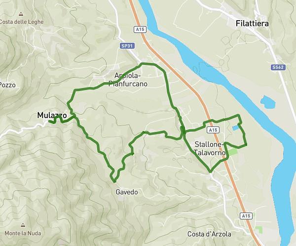
This walking route covers 7.414mi starting from Mulazzo, Massa-Carrara. The walk is a loop trail and returns to the trailhead. This walk is rated as hard, plan for about 2h39m to complete it. The route has an elevation gain of 1545ft and an elevation loss of 1529ft.
castagnetoli
Route details
21:27/mi
Pace
649 kcal
Calories burned
Loop trail
Route type
620ft
Min altitude
1306ft
Max altitude
Route profile
1545ft
Elevation gain
1529ft
Elevation loss
620ft
Min altitude
1306ft
Max altitude
How to get there
Trailhead: Via Roma 3, 54026 Mulazzo Massa-Carrara, Italy
GPS coordinates of the trailhead: 44.31495, 9.88936 / 44°18'53'' N, 9°53'21'' E