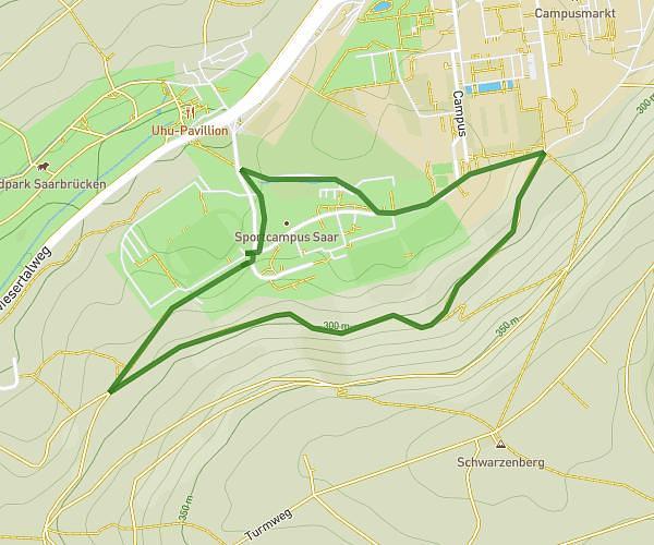
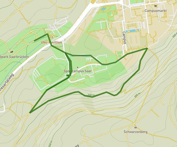
This running route covers 1.455mi starting from Saarbrücken, Saarland. The run is a loop trail and returns to the trailhead. This run is rated as easy, expect about 16m to complete it. The route has an elevation gain of 85ft and an elevation loss of 125ft.
B-Juniorinnen
Route details
5.46mph
Speed
183 kcal
Calories burned
Loop trail
Route type
860ft
Min altitude
984ft
Max altitude
Route profile
85ft
Elevation gain
125ft
Elevation loss
860ft
Min altitude
984ft
Max altitude
How to get there
Trailhead: Hermann-Neuberger-Straße 6, 66123 Saarbrücken, Germany
GPS coordinates of the trailhead: 49.25003, 7.03369 / 49°15'0'' N, 7°2'1'' E