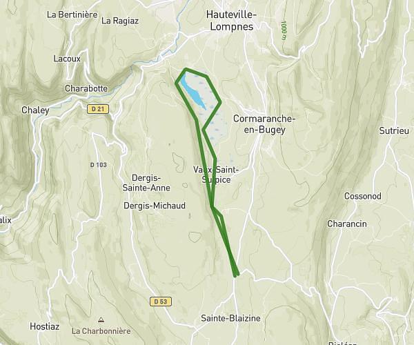
This running route covers 15.338mi starting from Ceyzérieu, Ain. The run is a loop trail and returns to the trailhead. This run is rated as strenuous, expect about 3h20m to complete it. The route has an elevation gain of 2028ft and an elevation loss of 2028ft.
Jdbb
Route details
4.6mph
Speed
2287 kcal
Calories burned
Loop trail
Route type
751ft
Min altitude
1526ft
Max altitude
Route profile
2028ft
Elevation gain
2028ft
Elevation loss
751ft
Min altitude
1526ft
Max altitude
How to get there
Trailhead: 3 Place Du Puits, 01350 Ceyzérieu, France
GPS coordinates of the trailhead: 45.82319, 5.72686 / 45°49'23'' N, 5°43'36'' E