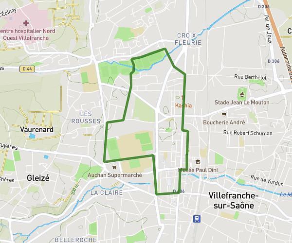
This running route covers 11.149mi starting from Saint-André-de-Corcy, Ain. The run does not return to the trailhead and ends near 800 Chemin Du Château, 01480 Ars-sur-Formans, France. This run is rated as hard, expect about 1h7m to complete it. The route has an elevation gain of 10ft and an elevation loss of 138ft.
ars par saint jean de thurignieux 2
Route details
9.99mph
Speed
766 kcal
Calories burned
Point to point
Route type
820ft
Min altitude
958ft
Max altitude
Route profile
10ft
Elevation gain
138ft
Elevation loss
820ft
Min altitude
958ft
Max altitude
How to get there
Trailhead: 311 Chemin De La Pousse, 01390 Saint-André-de-Corcy, France
GPS coordinates of the trailhead: 45.93844, 4.95211 / 45°56'18'' N, 4°57'7'' E