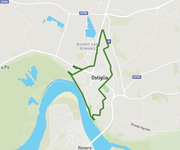
This running route covers 4.317mi starting from Ostiglia, Mantua. The run is a loop trail and returns to the trailhead. This run is rated as easy, expect about 46m to complete it. The route has an elevation gain of 154ft and an elevation loss of 154ft.
7 KM
Route details
5.63mph
Speed
526 kcal
Calories burned
Loop trail
Route type
30ft
Min altitude
69ft
Max altitude
Route profile
154ft
Elevation gain
154ft
Elevation loss
30ft
Min altitude
69ft
Max altitude
How to get there
Trailhead: Via Arrivabene 1, 46035 Ostiglia Mantua, Italy
GPS coordinates of the trailhead: 45.073219, 11.127509 / 45°4'23'' N, 11°7'39'' E