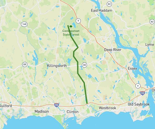
This hiking trail covers 12.611mi starting from Haddam, Connecticut. The hike does not return to the trailhead and ends near Chapman Mill Pond Road, 06498 Westbrook. This hike is rated as hard, plan for about 4h30m to complete it. The route has an elevation gain of 797ft and an elevation loss of 1191ft.
Cockaponset Marathon Hike (2nd half)
Route details
2.8mph
Speed
1928 kcal
Calories burned
3.0%
Avg grade
Point to point
Route type
39ft
Min altitude
502ft
Max altitude
Route profile
797ft
Elevation gain
1191ft
Elevation loss
39ft
Min altitude
502ft
Max altitude
How to get there
Trailhead: Old County Road, 06441 Haddam
GPS coordinates of the trailhead: 41.42671, -72.53794 / 41°25'36'' N, 72°32'16'' W