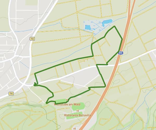
This running route covers 8.837mi starting from Stuttgart, Baden-Württemberg. The run is a loop trail and returns to the trailhead. This run is rated as hard, expect about 1h35m to complete it. The route has an elevation gain of 699ft and an elevation loss of 699ft.
test
Route details
5.58mph
Speed
1086 kcal
Calories burned
Loop trail
Route type
1158ft
Min altitude
1552ft
Max altitude
Route profile
699ft
Elevation gain
699ft
Elevation loss
1158ft
Min altitude
1552ft
Max altitude
How to get there
Trailhead: Im Oberen Kienle 83, 70184 Stuttgart, Germany
GPS coordinates of the trailhead: 48.765112, 9.189584 / 48°45'54'' N, 9°11'22'' E