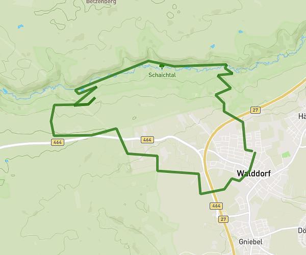
This running route covers 2.453mi starting from Nufringen, Baden-Württemberg. The run is a loop trail and returns to the trailhead. This run is rated as easy, expect about 26m18s to complete it. The route has an elevation gain of 253ft and an elevation loss of 253ft.
AnfangErweitert
Route details
5.59mph
Speed
301 kcal
Calories burned
Loop trail
Route type
1470ft
Min altitude
1601ft
Max altitude
Route profile
253ft
Elevation gain
253ft
Elevation loss
1470ft
Min altitude
1601ft
Max altitude
How to get there
Trailhead: Rohrauer Straße 67, 71154 Nufringen, Germany
GPS coordinates of the trailhead: 48.620682, 8.897702 / 48°37'14'' N, 8°53'51'' E