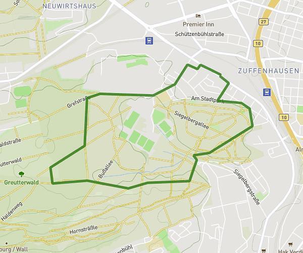
This running route covers 3.093mi starting from Filderstadt, Baden-Württemberg. The run does not return to the trailhead and ends near Metzinger Straße 17, 70794 Filderstadt, Germany. This run is rated as easy, expect about 33m10s to complete it. The route has an elevation gain of 243ft and an elevation loss of 249ft.
5km
Route details
5.59mph
Speed
379 kcal
Calories burned
Point to point
Route type
1230ft
Min altitude
1401ft
Max altitude
Route profile
243ft
Elevation gain
249ft
Elevation loss
1230ft
Min altitude
1401ft
Max altitude
How to get there
Trailhead: Schlesienstraße 11, 70794 Filderstadt, Germany
GPS coordinates of the trailhead: 48.65015, 9.2079 / 48°39'0'' N, 9°12'28'' E