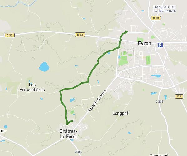
This hiking trail covers 6.271mi starting from Amné, Sarthe. The hike is a loop trail and returns to the trailhead. This hike is rated as easy, plan for about 2h1m to complete it. The route has an elevation gain of 482ft and an elevation loss of 482ft.
rando des fours
Route details
3.11mph
Speed
868 kcal
Calories burned
2.9%
Avg grade
Loop trail
Route type
220ft
Min altitude
525ft
Max altitude
Route profile
482ft
Elevation gain
482ft
Elevation loss
220ft
Min altitude
525ft
Max altitude
How to get there
Trailhead: 3 Route De Brains-Sur-Gée, 72540 Amné, France
GPS coordinates of the trailhead: 48.03766, -0.05679 / 48°2'15'' N, 0°3'24'' W