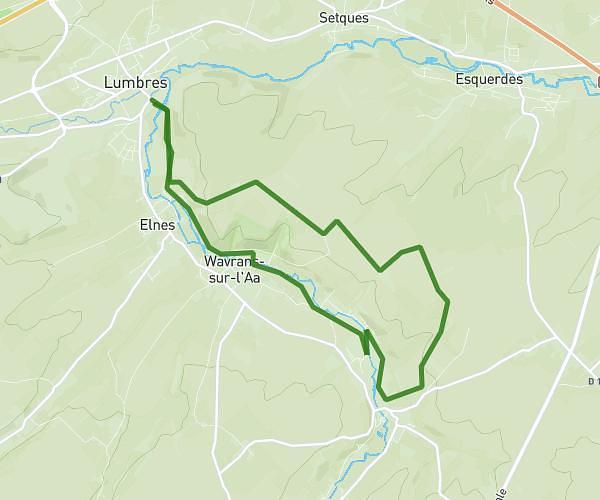
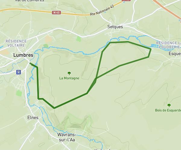
This walking route covers 7.719mi starting from Lumbres, Pas-de-Calais. The walk is a loop trail and returns to the trailhead. This walk is rated as strenuous, plan for about 2h20m to complete it. The route has an elevation gain of 479ft and an elevation loss of 486ft.
Lumbres par plouy et wilbe
Route details
18:09/mi
Pace
572 kcal
Calories burned
Loop trail
Route type
128ft
Min altitude
413ft
Max altitude
Route profile
479ft
Elevation gain
486ft
Elevation loss
128ft
Min altitude
413ft
Max altitude
How to get there
Trailhead: Impasse La Montagne, 62380 Lumbres
GPS coordinates of the trailhead: 50.7029, 2.12479 / 50°42'10'' N, 2°7'29'' E