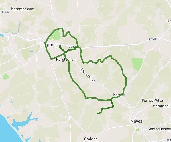
This running route covers 3.626mi starting from Melgven, Finistère. The run is a loop trail and returns to the trailhead. This run is rated as easy, expect about 7h50m to complete it. The route has an elevation gain of 217ft and an elevation loss of 220ft.
Kerangorant
Route details
0.47mph
Speed
5374 kcal
Calories burned
Loop trail
Route type
240ft
Min altitude
328ft
Max altitude
Route profile
217ft
Elevation gain
220ft
Elevation loss
240ft
Min altitude
328ft
Max altitude
How to get there
Trailhead: 6 Impasse De Bonne-Nouvelle, 29140 Melgven, France
GPS coordinates of the trailhead: 47.90851, -3.83595 / 47°54'30'' N, 3°50'9'' W