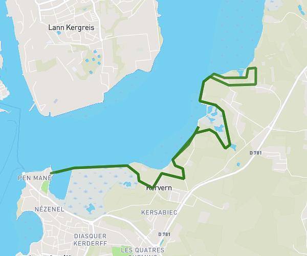
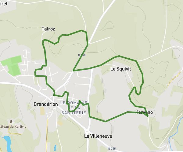
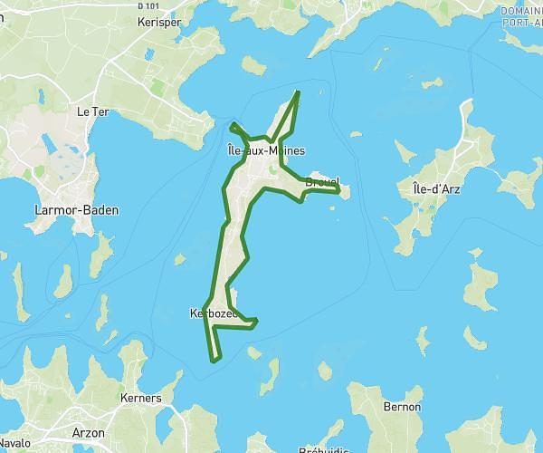
This running route covers 7.157mi starting from Guidel, Morbihan. The run is a loop trail and returns to the trailhead. This run is rated as moderate, expect about 1h10m to complete it. The route has an elevation gain of 128ft and an elevation loss of 82ft.
Course demain matin
Route details
6.13mph
Speed
800 kcal
Calories burned
Loop trail
Route type
23ft
Min altitude
151ft
Max altitude
Route profile
128ft
Elevation gain
82ft
Elevation loss
23ft
Min altitude
151ft
Max altitude
How to get there
Trailhead: 1 Rue De Beau Rivage, 56520 Guidel, France
GPS coordinates of the trailhead: 47.77244, -3.525692 / 47°46'20'' N, 3°31'32'' W