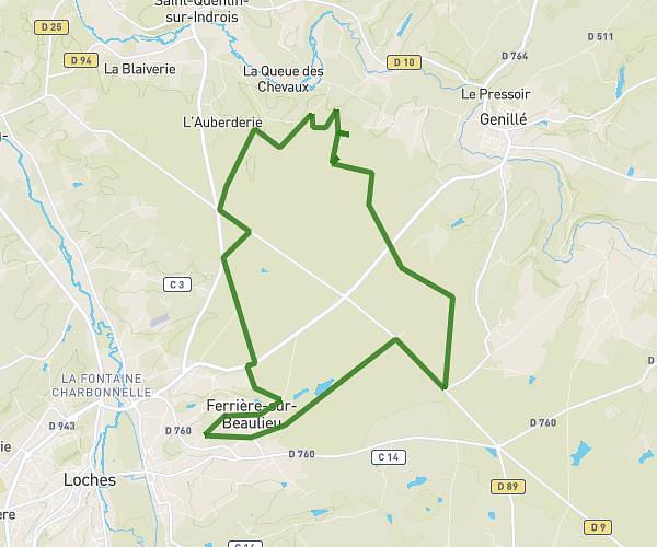
This running route covers 18.579mi starting from Bléré, Indre-et-Loire. The run is a loop trail and returns to the trailhead. This run is rated as strenuous, expect about 3h15m to complete it. The route has an elevation gain of 23ft and an elevation loss of 10ft.
Grande boucle 30KM
Route details
5.72mph
Speed
2230 kcal
Calories burned
Loop trail
Route type
180ft
Min altitude
197ft
Max altitude
Route profile
23ft
Elevation gain
10ft
Elevation loss
180ft
Min altitude
197ft
Max altitude
How to get there
Trailhead: 195 Rue Du Chemin Vert, 37150 Bléré, France
GPS coordinates of the trailhead: 47.31734, 0.99177 / 47°19'2'' N, 0°59'30'' E