MapPlanner
20.194mi
Distance
1h48m
Duration
11.2mph
Speed
+906ft
Elevation gain
-902ft
Elevation loss
Hard
Level

Vining-Bushy Hill

Route details

957 kcal
Calories burned
1.7%
Avg grade
Loop trail
Route type
174ft
Min altitude
446ft
Max altitude

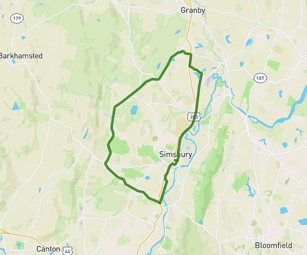
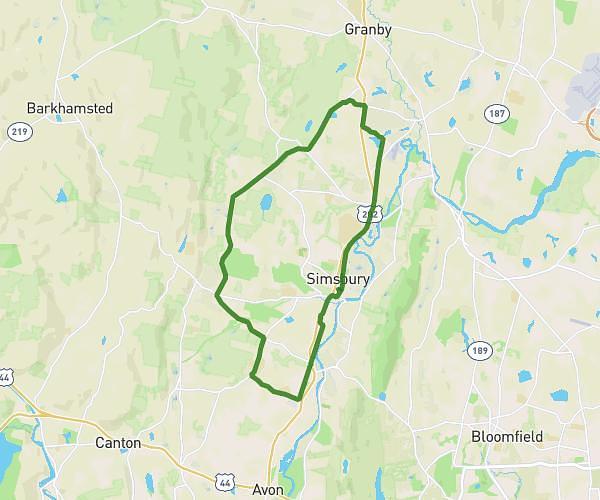
This cycling route covers 20.194mi starting from Connecticut, Granby. The ride is a loop trail and returns to the trailhead. This route is rated as hard, plan for about 1h48m to complete it. The route has an elevation gain of 906ft and an elevation loss of 902ft.

Route profile

906ft
Elevation gain
902ft
Elevation loss
174ft
Min altitude
446ft
Max altitude

How to get there

Trailhead: Fern Hollow Drive, 06035 Granby

GPS coordinates of the trailhead: 41.99384, -72.80786 / 41°59'37'' N, 72°48'28'' W

Caution: May Cross Private Property

This route may pass through or near private property. Always respect posted signs, obtain permission where required, and follow local trespassing laws. MapPlanner does not guarantee public access along any route.

Safety Notice

Trail and road conditions may change without notice due to weather, construction, or other factors. Always verify current conditions before heading out. You are responsible for your own safety — follow local signage, obey traffic laws, and use your best judgment on the trail.