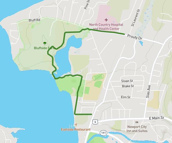
This cycling route covers 1.778mi starting from Newport, Vermont. The ride does not return to the trailhead and ends near 378 Prouty Drive, Newport, Vermont 05855, United States. This route is rated as easy, plan for about 3m to complete it. The route has an elevation gain of 102ft and an elevation loss of 95ft.
Newport - No Build (Current off-road facility) #1 Upper legs
Route details
27 kcal
Calories burned
2.1%
Avg grade
Point to point
Route type
673ft
Min altitude
735ft
Max altitude
Route profile
102ft
Elevation gain
95ft
Elevation loss
673ft
Min altitude
735ft
Max altitude
How to get there
Trailhead: 48 Landing Street, Newport, Vermont 05855, United States
GPS coordinates of the trailhead: 44.943635, -72.203793 / 44°56'37'' N, 72°12'13'' W