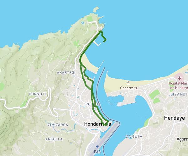
This hiking trail covers 5.538mi starting from Hondarribia, Gipuzkoa. The hike is a loop trail and returns to the trailhead. This hike is rated as moderate, plan for about 59m24s to complete it. The route has an elevation gain of 318ft and an elevation loss of 318ft.
Puntala-PADURA
Route details
5.59mph
Speed
423 kcal
Calories burned
2.2%
Avg grade
Loop trail
Route type
-3ft
Min altitude
36ft
Max altitude
Route profile
318ft
Elevation gain
318ft
Elevation loss
-3ft
Min altitude
36ft
Max altitude
How to get there
Trailhead: Nafarroa Behera Kalea 4, 20280 Hondarribia, Gipuzkoa, Spain
GPS coordinates of the trailhead: 43.362218, -1.78828 / 43°21'43'' N, 1°47'17'' W