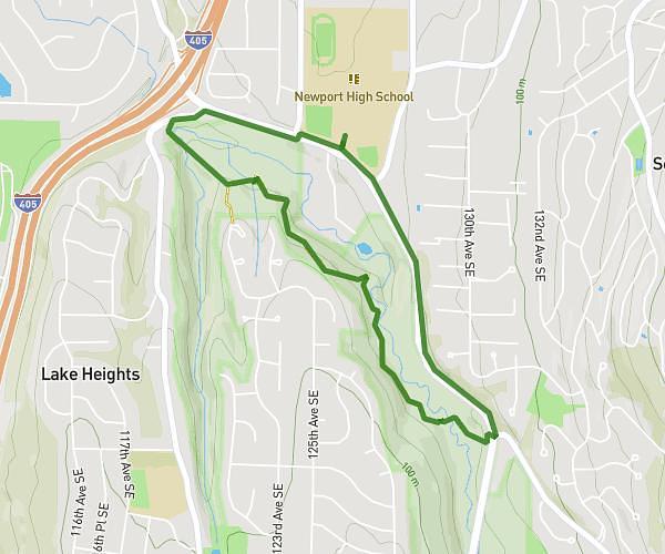
This running route covers 2.936mi starting from Bellevue, Washington. The run is a loop trail and returns to the trailhead. This run is rated as easy, expect about 19m34s to complete it. The route has an elevation gain of 256ft and an elevation loss of 256ft.
5k Loop
Route details
9.0mph
Speed
224 kcal
Calories burned
Loop trail
Route type
43ft
Min altitude
141ft
Max altitude
Route profile
256ft
Elevation gain
256ft
Elevation loss
43ft
Min altitude
141ft
Max altitude
How to get there
Trailhead: 4333 Factoria Boulevard Southeast, Bellevue, Washington 98006, United States
GPS coordinates of the trailhead: 47.567101, -122.172314 / 47°34'1'' N, 122°10'20'' W