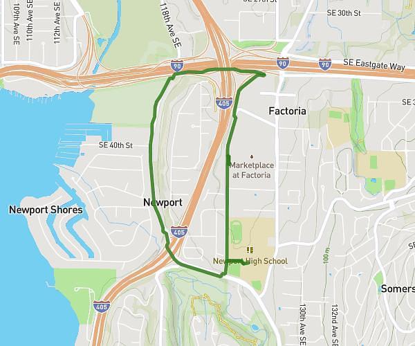
This running route covers 2.43mi starting from Bellevue, Washington. The run is a loop trail and returns to the trailhead. This run is rated as easy, expect about 16m12s to complete it. The route has an elevation gain of 538ft and an elevation loss of 535ft.
Coal Creek Ravine Loop
Route details
9.0mph
Speed
185 kcal
Calories burned
Loop trail
Route type
69ft
Min altitude
272ft
Max altitude
Route profile
538ft
Elevation gain
535ft
Elevation loss
69ft
Min altitude
272ft
Max altitude
How to get there
Trailhead: 4403 126th Pl SE, Bellevue, Washington 98006, United States
GPS coordinates of the trailhead: 47.56624, -122.172497 / 47°33'58'' N, 122°10'20'' W