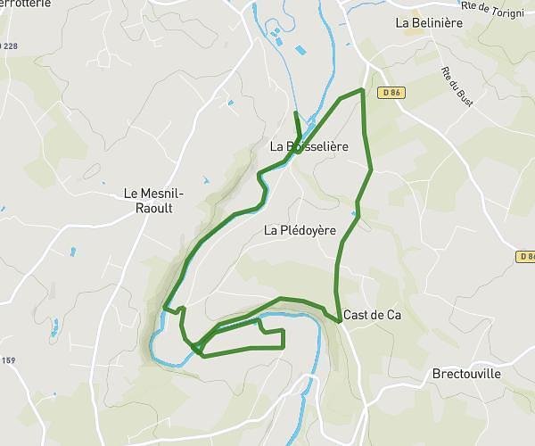
This running route covers 5.371mi starting from Saint-Jean-d'Elle, Manche. The run does not return to the trailhead and ends near D 290, 50810 Saint-Germain-d'Elle, France. This run is rated as moderate, expect about 58m to complete it. The route has an elevation gain of 200ft and an elevation loss of 413ft.
Essai 1
Route details
5.56mph
Speed
663 kcal
Calories burned
Point to point
Route type
344ft
Min altitude
581ft
Max altitude
Route profile
200ft
Elevation gain
413ft
Elevation loss
344ft
Min altitude
581ft
Max altitude
How to get there
Trailhead: 22 Route De L'aure, 50810 Saint-Jean-d'Elle, France
GPS coordinates of the trailhead: 49.102649, -0.944228 / 49°6'9'' N, 0°56'39'' W