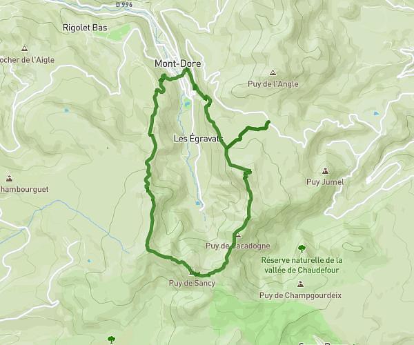
This hiking trail covers 6.445mi starting from Chastreix, Puy-de-Dôme. The hike is a loop trail and returns to the trailhead. This hike is rated as strenuous, plan for about 3h57m to complete it. The route has an elevation gain of 1634ft and an elevation loss of 1627ft.
Chastreix -Sancy
Route details
1.63mph
Speed
1792 kcal
Calories burned
9.6%
Avg grade
Loop trail
Route type
4593ft
Min altitude
5886ft
Max altitude
Steep climb
Route profile
1634ft
Elevation gain
1627ft
Elevation loss
4593ft
Min altitude
5886ft
Max altitude
How to get there
Trailhead: 5 Route De La Chambasse, 63680 Chastreix, France
GPS coordinates of the trailhead: 45.53525, 2.77938 / 45°32'6'' N, 2°46'45'' E