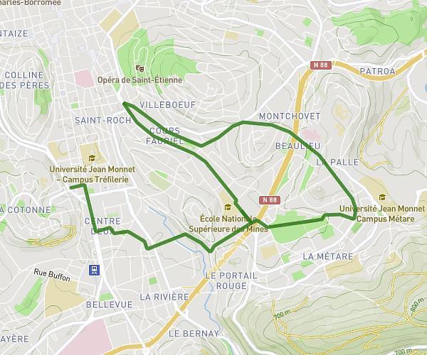
This running route covers 9.352mi starting from Boulieu-lès-Annonay, Ardèche. The run is a loop trail and returns to the trailhead. This run is rated as hard, expect about 1h52m to complete it. The route has an elevation gain of 1713ft and an elevation loss of 1709ft.
Sortie Boulieu Trail
Route details
4.97mph
Speed
1290 kcal
Calories burned
Loop trail
Route type
1483ft
Min altitude
2320ft
Max altitude
Route profile
1713ft
Elevation gain
1709ft
Elevation loss
1483ft
Min altitude
2320ft
Max altitude
How to get there
Trailhead: Place Des Écoles, 07100 Boulieu-lès-Annonay, France
GPS coordinates of the trailhead: 45.2713, 4.66564 / 45°16'16'' N, 4°39'56'' E